NY DAILY NEWS: by Amy Chester
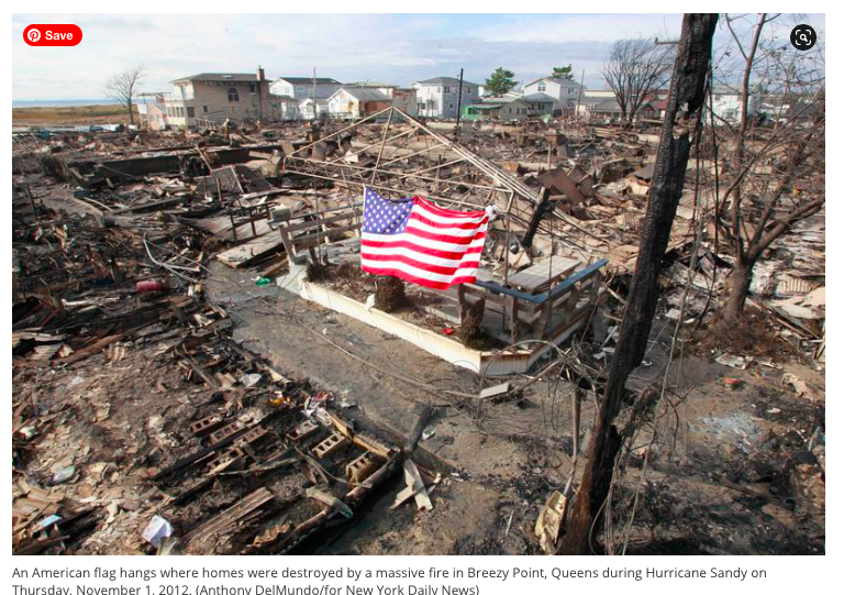
This week marks the eighth anniversary since Superstorm Sandy devastated our region. Perhaps understandably, as the country grapples with a new surge of COVID cases just a week before the election, this occasion has taken a back seat to the daily concerns of many. The pandemic reminds us, however, that disasters routinely have the greatest impact on physically and socially vulnerable populations.
As climate change causes a rise in sea levels and increases the likelihood of flooding and major storms, we need to better understand who will be at risk during these events. Analyzing the floodplain reveals a larger story: The number of New Yorkers who are highly vulnerable to increased coastal storms is even higher than the city has accounted for. We found that 14% of New Yorkers — 1.3 million people — live within or adjacent to the 100-year floodplain. Those communities have a 1% chance of experiencing a major disaster every year. If the impacts of climate change are left unabated, by 2100, this number could rise to 2.2 million.
We also found that over half of this population lives in areas considered low income by the federal government’s standard of $75,120 per three-person household in New York City, and that in line with the rest of the city, 56% of these residents identify as non-white.
Why is this important? Just as we are seeing with COVID, floods have a higher impact on the most vulnerable populations, which can include characteristics such as income, age, race and health. For example, the Urban Institute has found that four years after a medium-sized disaster, there is an average 31-point decline in credit scores for people living in communities of color, whereas people living in majority-white communities experienced a four-point decline. Further, the Federal Emergency Management Agency post-disaster programs largely focus on homeowners, but 63% of the floodplain population are renters.
New York’s Department of City Planning just announced new zoning to address resilience flooding. Their proposed plan solidifies the lower density zoning in a select number of the most high-risk neighborhoods, such as Broad Channel and Hamilton Beach, which are already experiencing regular flooding; there, only the construction of new single-family homes will be permitted.
However, in neighborhoods with only slightly less flood risk, such as Mott Haven and the Rockaways, the city will continue to allow new construction of high-rise development. This could attract thousands of new residents in areas of the five boroughs that, according to city government’s own appointed research panel, may see sea levels rise six feet by 2100.
With comprehensive policies and planning, the city can accommodate growth both in and out of the floodplain. Unfortunately, the city has initiated this zoning without any correlating neighborhood resilience planning efforts to ensure that the new residents, and those who live there today, will be safe as storms and floods become more common occurrences.
In areas that the city is siting new development, investments in infrastructure must be made so that emergency vehicles are guaranteed access on wet or dry days, adjacent roads and bridges will be clear of flooding to allow residents access to their jobs, and commercial districts will not suffer by leaving mom-and-pop businesses without income and communities without vital services.
Around the country, there are frustrated homeowners asking local governments to buy their land because they can no longer withstand the increased flooding. Many have made the argument that they should be given full-market-value for their property since the government has knowingly allowed development in these risky areas for decades. In the coming years, will the same challenge be made locally? Will our collective tax dollars be spent to bail out these unsuspecting homeowners? For all of our sake, including theirs, I sincerely hope not.
Along with maintaining lower density in the most flood-prone areas, the city should be increasing development opportunities on higher ground to accommodate the residents who already want to retreat from the shoreline. If done responsibly, increasing urbanization is also a win for the environment, as city-dwellers on average have a smaller carbon footprint than their suburban counterparts.
In the city’s proposal, only homeowners in the flood zones will be allowed to adapt or build new homes higher to accommodate wet-proofing on the ground level. Higher-ground neighborhoods should also have permitted height increases to increase the number of housing units in the parts of the city that will not be affected by increased flooding.
The 1.3 million New Yorkers who live in the areas most likely to be flooded — and the residents who have not moved there yet — are counting on the mayor to prioritize the most socially vulnerable.
Reactionary planning in response to disasters is too common. We need to prepare for a future that can withstand these increasing unfortunate events.
Chester is managing director of Rebuild By Design.
View it here.

 Follow Us on Twitter
 Subscribe to Rebuild on
