PROJECT PAGES: Resilient Bridgeport
BACKGROUND
Developed by: WB unabridged with Yale ARCADIS; with Waggonner and Ball Architects, unabridged Architecture, BumpZoid, Dorgan Architecture & Planning, Mississippi State University Gulf Coast Community Design Studio
The City of Bridgeport is the most densely-populated, ethnically diverse, and socially vulnerable city in Connecticut, and provides much-needed affordable housing for the area. Situated on the coast of Long Island Sound, Bridgeport is vulnerable to sea level rise, which would inundate power plants, wastewater treatment plants, hospitals, a financial center, sports and entertainment facilities, and a university.
By 2100, it is predicted that over half of Bridgeport could flood regularly. Transportation infrastructure, including the regional rail from Boston to New York City and the busy interstate highway, could be chronically disrupted.
Location: Bridgeport, Connecticut
Award: $10 Million
Implemented By: State of Connecticut
Status: Under Construction
PROPOSAL
Resilient Bridgeport lays out a comprehensive approach to protecting against climate change and storm surge and rainfall flooding that is also designed to stimulate environmental restoration, economic development, and neighborhood revitalization.
The pilot project from this plan focuses on the South End neighborhood, a low-lying peninsula exposed to sea level rise and storm surge. To better protect and connect the neighborhood, the original plan sought to elevate Singer Street, build a waterfront berm in historic Seaside Park, and establish offshore breakwaters.
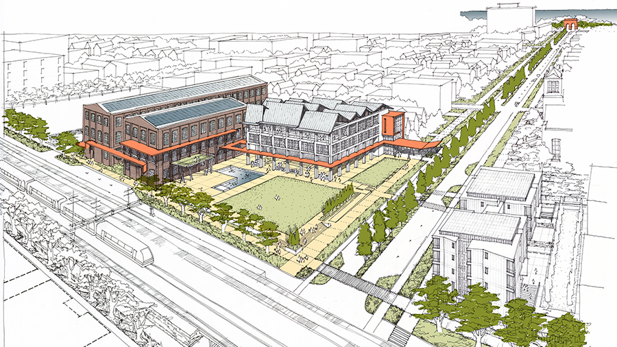
The original proposal also included a South End Resilience Education and Community Center, potentially providing the area’s 12,600 residents with workforce training, a fresh food cooperative, a health care clinic, a senior center, and child care facilities.
View the team’s full original proposal here.
IMPLEMENTATION PROGRESS
Resilient Bridgeport is now comprised of two pilot projects – Rebuild by Design (RBD) and Flood Risk Reduction Project (FRRP) – focused on protecting homes, businesses and infrastructure in Bridgeport’s South End from chronic and acute flooding in order to safeguard Bridgeport’s most vulnerable communities and foster long-term local prosperity.
The RBD pilot project on the west side near Marina Village includes elevating an extension of Johnson Street to support dry egress adjacent to a stormwater park that will serve as a recreational space when dry and a rainwater detention and drainage catchment during storms. Also included is a public plaza and pump station. The collected stormwater is pumped to a repurposed outfall at the head of Cedar Creek. On the South End’s east side, the FRRP provides an integrated coastal defense system with a buried flood wall within raised street profiles and the adjacent belvedere (an elevated structure intended to provide views). From the raised belvedere structure stormwater is conveyed into Seaside Park. The project also includes a new pump station with educational programs, a set of stairs and ramps, and a reworked landscape at a previously soggy area of Seaside Park.
The 90% final designs for both projects were submitted for review in January and permit applications were underway as of Spring 2022. The State has also secured an additional $10.25 million worth of grants for the FRRP project.
Click here to view the 10-year Hurricane Sandy Anniversary Update on this project.
Visit the project website here to learn more about this project and sign up for updates.
Budget: $66.25 million ($10M CDBG-DR grant through Rebuild by Design, $46M through National Disaster Resilience Competition, $10.25M gathered by State for FRRP)
Press:
- ‘The budget growing is concerning’: Bridgeport flooding project nears construction, but over budget, CTPost (March 2022)
- Storm front: Yale center helps Bridgeport plan for climate threats, Yale News (Dec 2020)
- Report Emphasizes Importance of Communication in Climate Change Resilience, UConn Today (Jan 2020)
- Bridgeport building barriers after swamped by stormwaters, CT Post (Sept 2019)