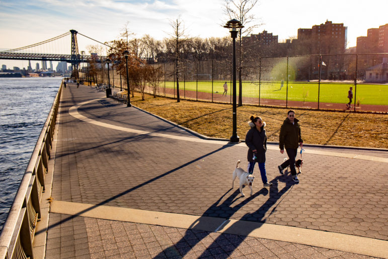
City Limits: Almost seven years have passed since Hurricane Sandy left its mark in the city. Neighborhoods like the East Village and Lower East Side were severely impacted by flooded streets and loss of electric power. Beyond the loss of life and the price of rebuilding, the storm also delivered a warning about what the city can expect as sea levels rise.
A study conducted by several American institutions suggested rising sea levels makes the city vulnerable to floods that will happen every five years after the year 2030.
Flooding can be damaging to the city’s infrastructure and economy, which is why the city and federal resources are currently being hauled together to protect the city through two flood protection initiatives – the East Side Coastal Resiliency Project and the U.S. Army Corps of Engineers’ New York and New Jersey Harbor Tributaries Study.
As these initiatives start to come to fruition, skepticism continues to surround the projects over funding and their capability to protect New York City’s vulnerable coastal communities.
The East Side Coastal Resiliency Project (ESCR)
In 2014, the U.S. Department of Housing and Urban Development’s Rebuild by Design competition awarded the city $335 million to fund the first phase of a flood protection initiative in Lower Manhattan, called the Big U, which involves rebuilding the East River Park. The city provided an additional $425 million to the project, bringing the cost of total funding to $760 million. READ MORE>>
 Follow Us on Twitter
 Subscribe to Rebuild on
